产品介绍
第一批国际湿地城市2015与2022年土地覆盖数据及湿地类型数据集。
数据说明
1. 数据空间范围(北京市,京津冀,全国,全球,特定地区)
第一批国际湿地城市(常德、常熟、东营、海口、哈尔滨市区、银川市区)
2. 数据时空分辨率,时间跨度
2015年、2022年,空间分辨率为10m
3. 数据类型(矢量、栅格、图片等)
栅格
4. 数据源说明
利用Sentinel-1/2遥感影像数据通过监督分类的方式得到10米分辨率的土地覆盖数据集,通过逐层分类的方式得到10米分辨率的湿地类型数据集
5. 数据精度
80%~90%左右
6. 预计数据量(MB,GB)
450 MB
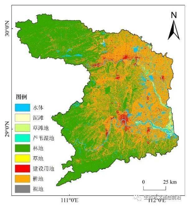
影像展示
产品文献
[1] Wang X, Jiang W, Peng K, et al. A framework for fine classification of urban wetland based on random forest and knowledge rules: Taking the Wetland City of Haikou and Yinchuan as examples [J]. GIScience & Remote Sensing, 2022,59(1): 2144-2163.
[2] Wang X, Jiang W, Deng Y, et al. Contribution of Land Cover Classification Results Based on Sentinel-1 and 2 to the Accreditation of Wetland Cities [J].Remote Sensing, 2023, 15(5), 1275.